Crestview Hayward Townhouses
- Subject:
- Master Planning - Residence - Multi-Family Housing
- Project Number:
- 0635
- Date:
- January 1973-November 1973
- Client:
- Kaufman and Broad Inc. (Kay Building Company)
- Location:
- East Ave. and Winchester Road, Hayward, California
- Project Name:
- Crestview Hayward Townhouses
- Site: 20 acres
- Project development goals: 120 townhouses consisting of 67 two bedroom apartments, and 53 three bedroom apartments, creating a gross density of 6 units per acre or 10 units per acre net density. Sales price of apartments ranged from $32,000 to $38,000
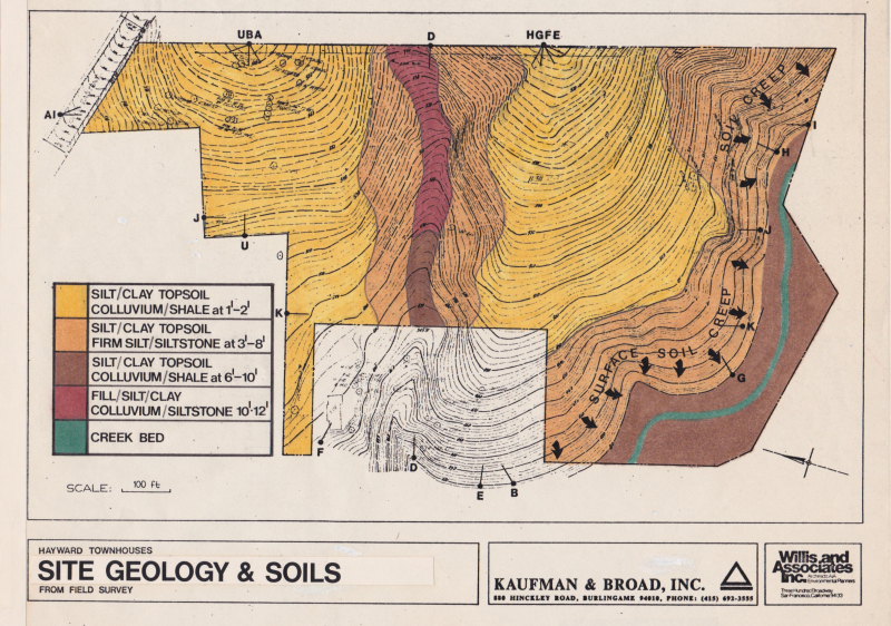
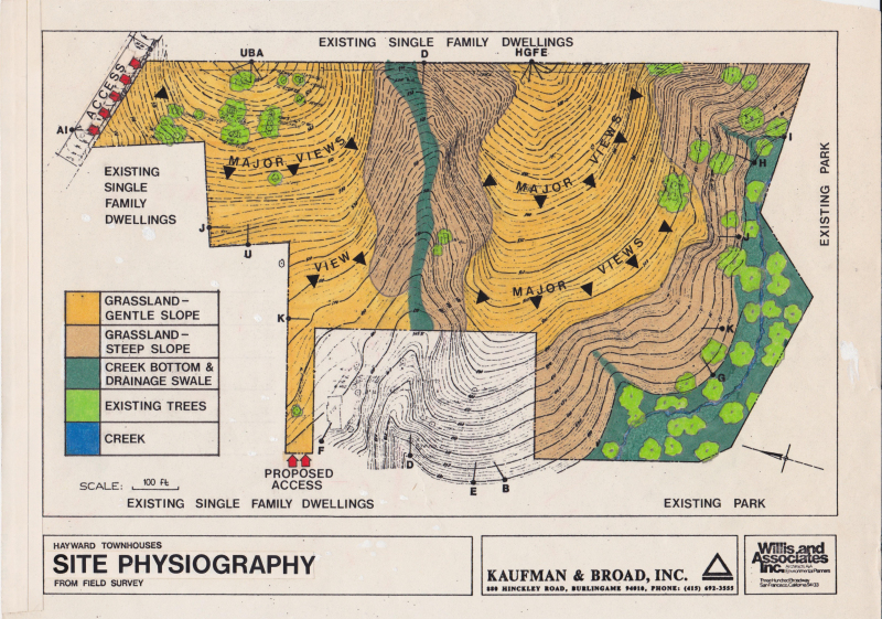
- Terrain: Gently sloping hillside with a creek on one side of the property. Soil was creeping into the creek bed below the 450 feet contour line. An existing gully with saturated soil conditions traversed the middle of the site
- Amenities: Recreation center, swimming pool, boat and trailer storage, play area.
- County required that private roads to be built 20 feet wide instead of the public works requirement of 60 feet.
The well-known building firm of Kaufman and Broad, Inc. was offered the opportunity to purchase a 20-acre parcel of gently sloping hillside property, which commanded sweeping views of the San Francisco Bay.
The seller, a builder himself, had previously retained an experienced, award winning, architectural and landscaping firm to develop townhouse plans for this project. After 18 months of work, the project had been planned and had received all required agency approvals. However, estimated site-development costs based on this approved plan made it financially unfeasible from his point of view to proceed with construction. Discouraged, the builder decided to offer the land for sale.
Because the price was attractive, Kaufman and Broad expressed interest in purchasing provided development costs could be reduced by 35 percent or $2,000 per townhouse. Kaufman and Broad asked Willis, if using the CARLA process construction costs could be reduced. We found on this project, like so many of the one we did, that planning on multiple acres with little or incorrect information could lead to planning decisions that were environmentally destructive, sometime dangerous, and always costly.
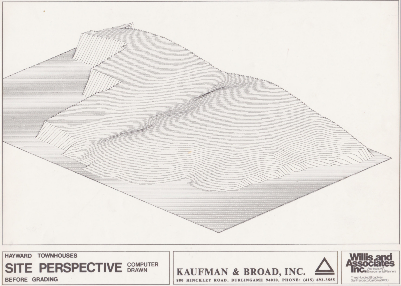
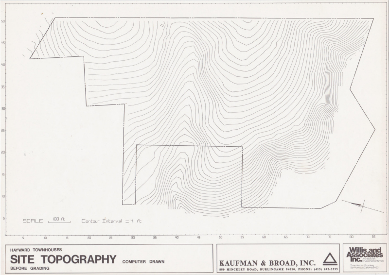
Before we could begin planning, we had to determine if the topography map given us was correct. It wasn’t. We authorized the civil engineer to correct the map surveying it on the ground. The original map had been made from data photographed from the air. As so often happens, aerial topography data resulted in elevations of the treetops covering the land. Such information can vary substantial from actual land levels.
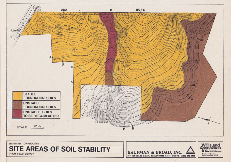
To identify the soil composition of the site and the areas of different types of soil, we commissioned an aerial geophysical analysis that used stereoscopic pairs photography and site-scanning radar mapping. This work found areas of unstable soil, extremely hard rocky soil and a soil-creep adjacent to the existing creek
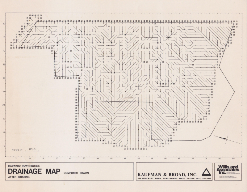
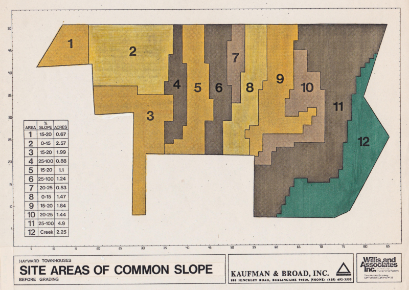
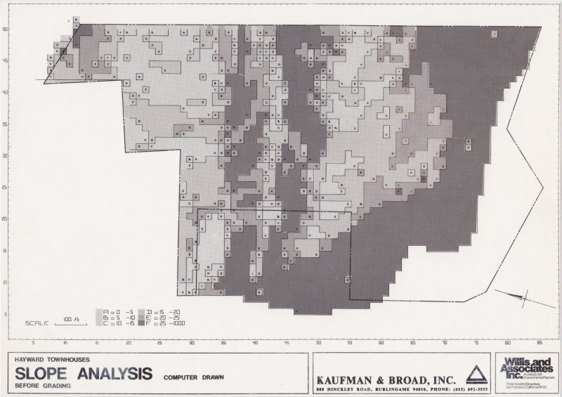
Using a corrected topography map that was manually digitized into the drafting computer, a computer-generated CARLA drainage and slope map identified areas of natural storm water flow and showed that the primary drainage ran into a swale that traversed the middle of the property.
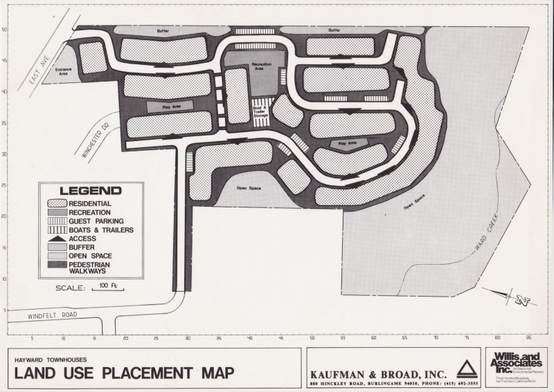
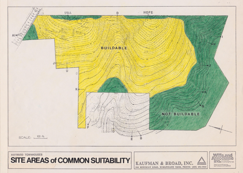
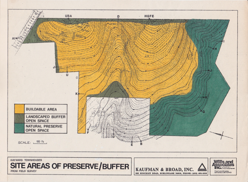
We overlaid the topography, drainage and soils maps to identify land that should not be built on. Land that we considered unbuildable was put into open space. CARLA’s land use analysis programs, based upon our library of hundreds of townhouse ground level plans and sections, when combined with the synthesized site maps confirmed that the best locations for the 120 townhouses was on specific small areas of the land and in varied clustered groupings. This meant greater light and air for more homes.
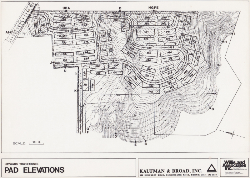
After going through the CARLA planning process, we determined that excessive construction costs of large clusters of townhouses could be avoided by these strategies: a) placing townhouses so that the buildings would not block drainage flow; b) placing the buildings on slopes where deep cuts would not have to be made in hard soil; and c) placing structures at grade elevations where gravity-flow storm water and sewage systems could be utilized.
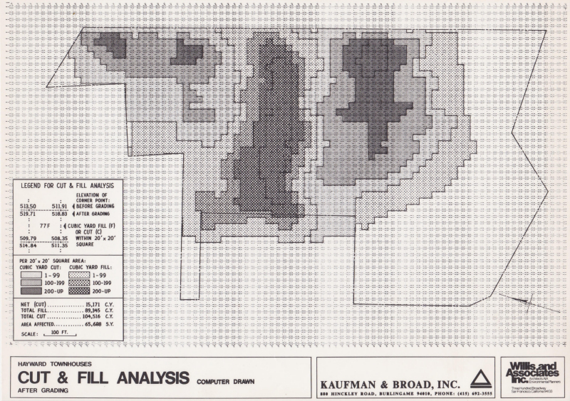
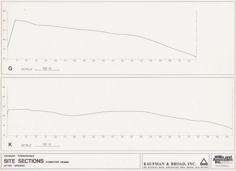
These strategies guided our plan. We reduced grading 35 percent from the previous plan by others. We placed the townhouse so each had a view. The smaller townhouse clusters covered less land, reduced the amount of construction needed for roads, storm water drainage, and utilities. This made the pumping station for storm and water drainage proposed by the earlier plan unnecessary, a savings of $50,00. Building on areas of unstable soil would have required costly special foundations. So all, the inhabitant, environment, and the builder benefited from working with nature.
The computer-generated Alternative Massing Configurations program also showed that best land use, one with minimum impact on the surrounding community, was to install a new major entry road and abandon its existing access road. Even with adding the new access road, development costs were reduced by 35 per cent. The builder was able to build less expensive townhouses at a profit while creating open space and new landscaped areas.
The buildings were designed by the previous architect.
